Encompassing some of the highest mountains in the eastern U.S. as well as some of the most bio-diverse temperate forests in the world, the Great Smoky Mountains on the Tennessee-North Carolina line are a hiker’s paradise. Mostly encompassed in Great Smoky Mountains National Park, this most famous range of the Southern Appalachians rewards those willing to lace up and leave the asphalt behind with luxuriant temperate rainforest, roaring waterfalls, and no shortage of soul-stirring mountain-upon-mountain vistas.
With such an abundance of world-class hiking, it’s not easy whittling down the very best trails in the Great Smokies—but we’re giving it a go here!
Rainbow Falls Trail

This 5.4-mile (R/T) trail off the Roaring Fork Motor Nature Trail accesses the tallest single-drop waterfall in the national park. At 80 feet, Rainbow Falls is quite the payoff for a fairly demanding hike covering some 1,500 feet of elevation gain and requiring for most people three to four hours in total. The rough, occasionally rocky trail shadows LeConte Creek, which flows off the northwestern shoulders of Mount LeConte—the third-highest peak in the Great Smokies—and takes that awesome free fall along the way.
Trail Difficulty: Moderate
Trail Length: 5.4 Miles
GPS Directions: Here
Rainbow Falls gets its name from the rainbows commonly appearing in its shimmering mist in the afternoon, especially in the summertime. If your hiking boots are still itchy after soaking up the splendor of Rainbow Falls, you can continue along the trail another four miles or so to the crown of Mount LeConte.
Alum Cave Trail to Mount LeConte

The Alum Cave Trail reaches Mount LeConte from the other side of this mighty summit and offers up some of the most intriguing geology and stirring scenery in the Great Smoky Mountains National Park as it does. About 11 miles round-trip and incorporating 2,700 feet of elevation gain, this is an all-day sort of trail, but you’ve got many natural rest stops along the way and the kind of sights that’ll keep the old hiking muscles firing.
Trail Difficulty: Challenging
Trail Length: 11 Miles
GPS Directions: Here
An early attraction on the Alum Cave Trail is Arch Rock, a slate portal you’ll pass through via rock stairs. At about the two-mile point, Inspiration Point is indeed inspiring with its long mountainscape vistas. A bit before the halfway mark, you’ll reach Alum Cave Bluff: a gigantic alcove on the flanks of Peregrine Peak that offers a shady stopover. The trail steepens beyond Alum Cave Bluff and the views continue to broaden as you hoof it to the 6,593-foot summit of one of the grandest peaks in the Great Smokies.
Mingo Falls

Situated in the Qualla Boundary lands of the Cherokee people right outside Great Smoky Mountains National Park, Mingo Falls ranks among the tallest waterfalls in the entire Southern Appalachians: a gorgeous 120-foot horsetail drop. “Mingo” in Cherokee means “big bear,” and the “Big Bear Falls” lie just upstream of where Mingo Creek merges into the Raven Fork of the Oconaluftee River.
Trail Difficulty: Easy
Trail Length: .5 Miles
GPS Directions: Here
Reaching Mingo Falls requires only a ¾-mile walk, though that walk begins with 160 or so stairs to get the heart rate going. If you’re strapped for time, you can bang this out in maybe a half-hour or so, but take it from us: You’re going to want to linger at Mingo Creek’s magnificent tumble.
Laurel Falls Trail

The 80-foot, double-decker drop of Laurel Falls is one of the most popular attractions in the Great Smokies, and the trail reaching it is, at 2.6 miles, the longest fully paved path in the national park. You’ll gain about 314 feet on the moderately difficult there-and-back hike along the Laurel Branch, which usually takes about two hours unless you decide to bask awhile in the beauty of the falls—not a bad idea.
Trail Difficulty: Easy
Trail Length: 2.4 Miles
GPS Directions: Here
The trail culminates in a walkway between the upper and lower falls, which needless to say translates to some awesome photo ops.
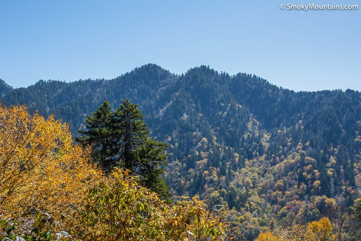
Clingmans Dome Hike

The pinnacle of the Great Smokies, 6,643-foot Clingmans Dome also ranks as the third-highest mountain in the eastern U.S. Its parking area offers far-reaching views, but there’s an even more stunning panorama awaiting those who slog up the steep paved path a half-mile to the observation tower at the summit. When conditions are clear, the sightlines from the top of Clingmans Dome extend 100 miles: an unforgettable vista, for sure.
Trail Difficulty: Easy
Trail Length: 1 Mile
GPS Directions: Here
The footpath up isn’t long, but the grade will have you huffing and puffing a bit, and remember to have a jacket or pullover with you even on a summer’s day: It’s typically significantly cooler and damper here at the conifer-cloaked high point of the Great Smokies than the lower elevations.
Chimney Tops Trail

The raw slate spires of the Chimney Tops create some of the most dramatic topography in the Great Smokies and also serve up some of the most dazzling scenery. No surprise, then, that the 3.8-mile (R/T) Chimney Tops Trail is one of the most popular in Great Smoky Mountains National Park. It’s certainly not among the easiest. There are close to 1,500 feet of elevation gain, though the hard grades eased a bit by stairs in places.
Trail Difficulty: Moderate
Trail Length: 3.8 Miles
GPS Directions: Here
The observation platform at the end of the trail—opened in 2017 after a wildfire made the original turnaround point at the Chimney Tops too unsafe—provides awesome views not only of the slate crags themselves but also the magnificent loom of nearby Mount LeConte.
Trillium Gap Trail to Mount LeConte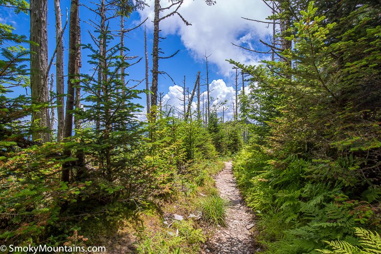
A number of different paths access the third-highest peak in the Great Smokies, and one of the all-around best is the Trillium Gap Trail. Close to 14 miles round-trip, this route spreads out the 3,401 feet of elevation gain for a gentler ascent than, say, the Rainbow Falls Trail, and along the way, it passes behind the remarkable 25-foot liquid curtain of Grotto Falls.
Trail Difficulty: Hard
Trail Length: 14 Miles
GPS Directions: Here
You’ll have access to multiple world-class vantages on Mount LeConte, most notably Myrtle Point, and you might be lucky enough to run into one of the llama pack strings that haul supplies along the Trillium Gap Trail to LeConte Lodge.
Start Your Hiking Experience Today!

All in all, you can never go wrong with a hiking experience while visiting the Great Smoky Mountains. Whether you’re in for an easy trail and hiking experience or you’re looking for incredible challenging hikes that lead you to a great summit, you won’t be disappointed by these top trails!