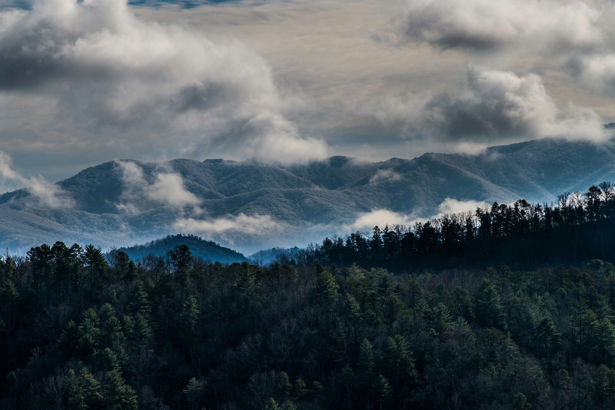
You can enjoy much of the Great Smoky Mountains have to offer on a day trip visit by car, maybe (ideally) with a short walk woven in. You can deepen your appreciation of this fabulous heartland of the Southern Appalachians by RV-ing or tenting out at one of the many car campgrounds the Park Service maintains.
But for the deepest, most intimate connection with these ancient, lushly-clad highlands, you should consider a taste of Smoky Mountain backpacking. From that standpoint, the park’s probably best known for the shelters and sites it offers thru-hikers hoofing it along the Appalachian Trail, which traces the Smoky Mountain crest. Yet with better than 800 miles of trails weaving through the wild depths of the Smokies, there are plenty of other options for backpackers.
To orient yourself to camping in the Great Smokies—including bedding down at the many backcountry sites in the park—we’ll steer you to this comprehensive guide of ours. It includes the nitty-gritty of camping regulations, including how to go about securing permission to backpack in this well-loved place.
Here, we’re spotlighting just a few of the awesome backcountry campsites in the park: not in an effort to catalog the “best,” but to cover at least some of the vast ground the Smoky Mountain backcountry represents, and provide a rough blueprint for adventure-planning.
Campsite No. 32–Grapeyard Ridge Trail
GPS Directions Here
The Grapeyard Ridge Trail is a great example of the many “hidden-treasure” sorts of trails in the Great Smokies. Linking the Greenbrier area in the east with the marvelous Roaring Fork Motor Nature Trail in the west, this up-and-down, 7.6-mile (one-way) footpath in the park’s north-central zone is usually a surefire guarantee of solitude.
It also shows off a slew of historic sites, including backcountry cemeteries and the well-known steam-engine wreck in Injun Creek. Backcountry campsite No. 32 provides a quiet overnighter spot about midway down the trail.
Campsite No. 13–Gregory Bald Trail
GPS Directions Here

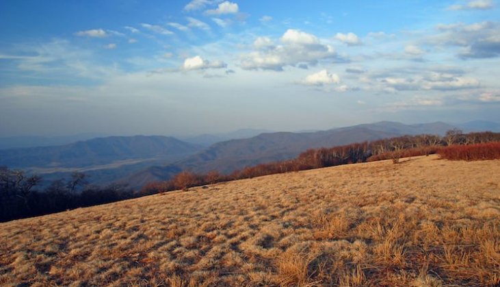
The high-country grassy expanse of Gregory Bald, set at nearly 5,000 feet along the Great Smoky Mountain crest, is one of the indisputable highlights of Great Smoky Mountains National Park. The views from this elevated, breeze-caressed stage are extraordinary: taking in the great basin of Cades Cove and the waters of Fontana Lake far below, plus nearby promontories such as Rich and Thunderhead mountains and Clingman’s Dome, plus farther-off highlands such as the Yellow Creek Mountains. And in June, Gregory Bald wears the grandest costume of blooming azaleas in the Great Smokies: arguably the single most beautiful and memorable seasonal destination in the park. (And that’s saying something!)
Fit hikers can tackle Gregory Bald from a couple of different routes in a day, but why not extend your enjoyment by backpacking? Campsite No. 13 at Sheep Pen Gap, just shy of the junction of the Gregory Bald and Wolf Ridge trails and not far below the grand meadow itself, offers that fantastic opportunity.
Campsite No. 50–Chasteen Creek Trail
GPS Directions Here

The extended, 30-foot whitewater tumble of the Chasteen Creek Cascades rank among the truly magical places in the backcountry of Great Smoky Mountains National Park. And Backcountry Campsite No. 50—the Lower Chasteen Campsite—serves as one of the most beginner-friendly backpacking bed-downs in the park.
The campsite’s just a short ways up the Chasteen Creek Trail from its junction with the Bradley Fork Trail, the first leg of the hike to the Cascades accessed from Smokemont Campground. This is a mighty pleasant stretch of tread, running along as it does the Oconaluftee River’s murmuring Bradley Fork. (The Bradley Fork and Chasteen Creek trails are part of the long-distance Benton MacKaye Trail, a quieter alternative to the Appalachian Trail that roughly parallels, to the south, that world-famous route.)
Just a few miles’ hike out from Smokemont Campground, the Lower Chasteen Campsite makes an excellent option for first-time backpackers testing the waters in the big and beautiful wildlands of the Great Smokies. Use it to take a gander at the wonderful Chasteen Creek Cascades, accessed via a spur path off the Chasteen Creek Trail, and—in spring and early summer—to enjoy a fabulously representative display of Southern Appalachian wildflowers.
Campsite No. 84—Hazel Creek & Jenkins Ridge Trails
GPS Directions Here

Photo Credit by @nancypeast on Instagram
The southwestern sector of Great Smoky Mountains National Park is one of its most remote and lightly visited. That makes it a draw in and of itself for those seeking solitude in the nation’s most popular national park. It delivers an unforgettable sense of the deep quiet and wilderness vibe that defines much of the Great Smokies even today, for those willing to tromp the miles.
Campsite No. 84, which marks the spot where the Jenkins Ridge and Hazel Creek trails meet, delivers a fine spot to soak up that backcountry hush. The long Hazel Creek trail runs nearly 15 miles between its southwesterly trailhead near Fontana Lake and Mule Creek Gap. For most of its length, it’s a gentle, welcoming grade. The roughly 7-mile-long Jenkins Ridge Trail heads up at Spence Field, cutting away from the Appalachian Trail to mosey south along Jenkins Trail Ridge (confused yet, name-wise?) and then southeast to meet the Hazel Creek track.
Backcountry Bliss in the Great Smoky Mountains

The above four are, again, a mere sampling of what backpacking in the Great Smoky Mountains looks, feels, smells, and sounds like. If you’re physically able and have the requisite gear—which, ultimately, doesn’t have to amount to all that much, nor a pocketbook-breaking expense—these backcountry sites and others like them offer a Smoky Mountain experience worlds away from the hubbub of the “front-country.”