
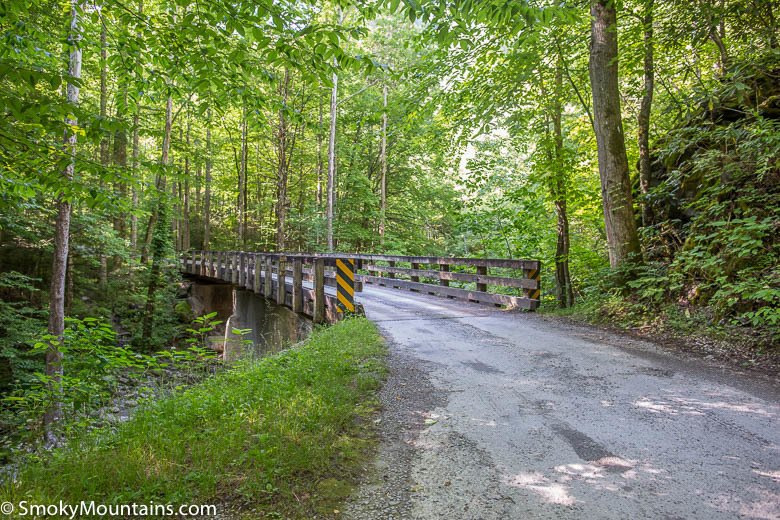


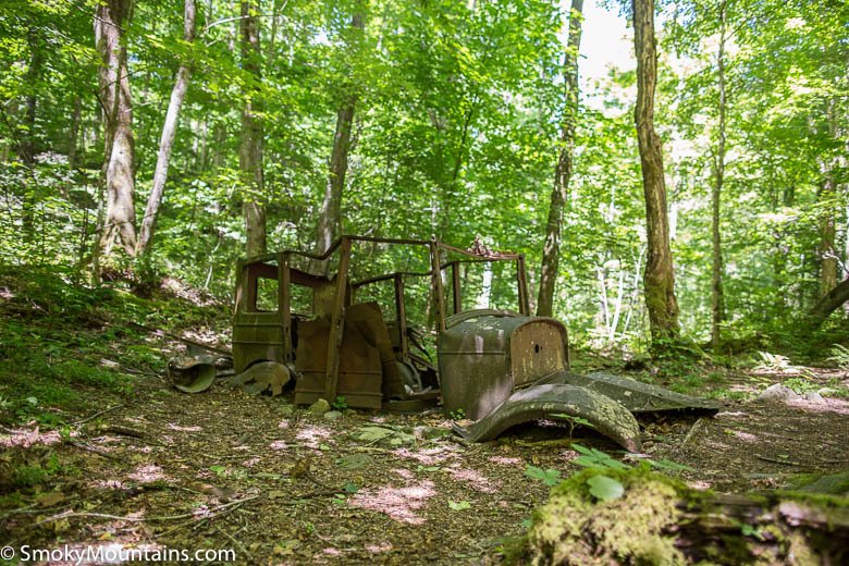


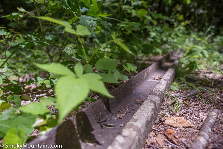


Indian Flats Falls is a series of four modest waterfalls, each approximately 10 to 15 feet high. The hike to the falls begins behinds the end of Tremont Road and follows an old railroad grade built by Little River Lumber Company in the early 1900’s. Follow the bridge over Lynn Camp Prong and stay left on the main gravel road. Since the trail is open to equestrians, keep an eye out for horse pies to avoid having a stinky hiking boot for the rest of the day! After half a mile on the trail, the road swings to the left at the largest set of cascades for the Lynn Camp Prong, revealing one of the Smokies’ most photographed locations.
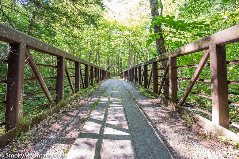
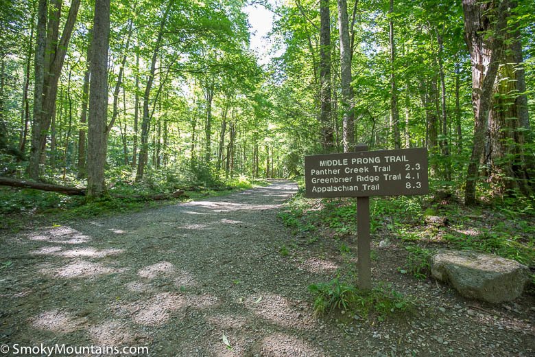
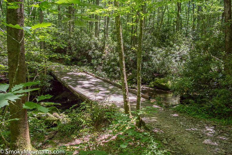
The well-maintained trail continues along the Indian Flats Prong. At 2.3 miles, you’ll cross the junction with Panther Creek Trail on your left. Continue straight on the main road. At 3.5 miles, cross a bridge over Indian Flats Prong. The trail progresses under a vine-draped canopy with rhododendron growing along the forest floor. The grade steadily increases as the trail makes several sharp left-hand switchbacks followed by a right-hand switchback.
At 3.9 miles, you’ll reach the unmarked trail spur to upper Indian Flats Falls. While the waterfall will not yet be visible, you’ll certainly hear the falls as you reach the unmarked spur located behind a large boulder at a sharp, steep bend in the trail. Proceed a few hundred feet over rocks to reach the base of the uppermost set of Indian Flats Falls. While it’s rare to miss the falls spur, you’ll know you’ve gone too far if you reach the Lynn Camp Prong Trail split a quarter mile further down the trail.
Indian Flats Falls includes four separate scenic drops. However, only the uppermost drop is easily accessible. You’ll have to scramble over boulders and under rhododendron thickets in order to reach the additional drops, which is inadvisable even in the best weather. Not only will doing so risk your own safety, but you’ll also unnecessarily damage the vegetation and soil along the creek bank and risk being bitten by a timber rattlesnake or copperhead. Instead, enjoy a short break at the uppermost falls, snap a few photos, and then return to the trailhead by reversing your route.
Driving Directions:
Head southwest from the Townsend Y junction of Little River Road and TN 73 towards Cades Cove. After a short drive (0.2 mile), turn left onto Tremont Road. After two miles, you’ll pass the Great Smokey Mountains Institute at Tremont on your left before the road changes to gravel. Continue three additional miles down the gravel road before reaching the road’s end. Park here for the trailhead. On busy weekends, arrive early to secure a parking space near the trailhead.

Insider Tips:
-In winter, the last three miles of Tremont Road are closed to cars. In good weather, turn Indian Flats Falls into a bike-hike combo trip. Park at the road closure and bike the remaining three miles to the trailhead. Note that bikes are not allowed on the trail.
-Bear activity is common along the Middle Prong Trail, especially in the fall. Keep an eye out for potential sightings while hiking.
-While the best time to hike Indian Flats Falls is spring or fall, the trail is a fun, enjoyable hike any time of year. In April, dwarf irises, trilliums, jack-in-the-pulpits, violets and other wildflowers carpet the forest floor. In October, autumn foliage lights up the trail.
-The nearest restrooms are located at the Great Smoky Mountains Institute at Tremont. If the facility is closed, head back to the Cades Cove Picnic Area or stop in the town of Tremont.