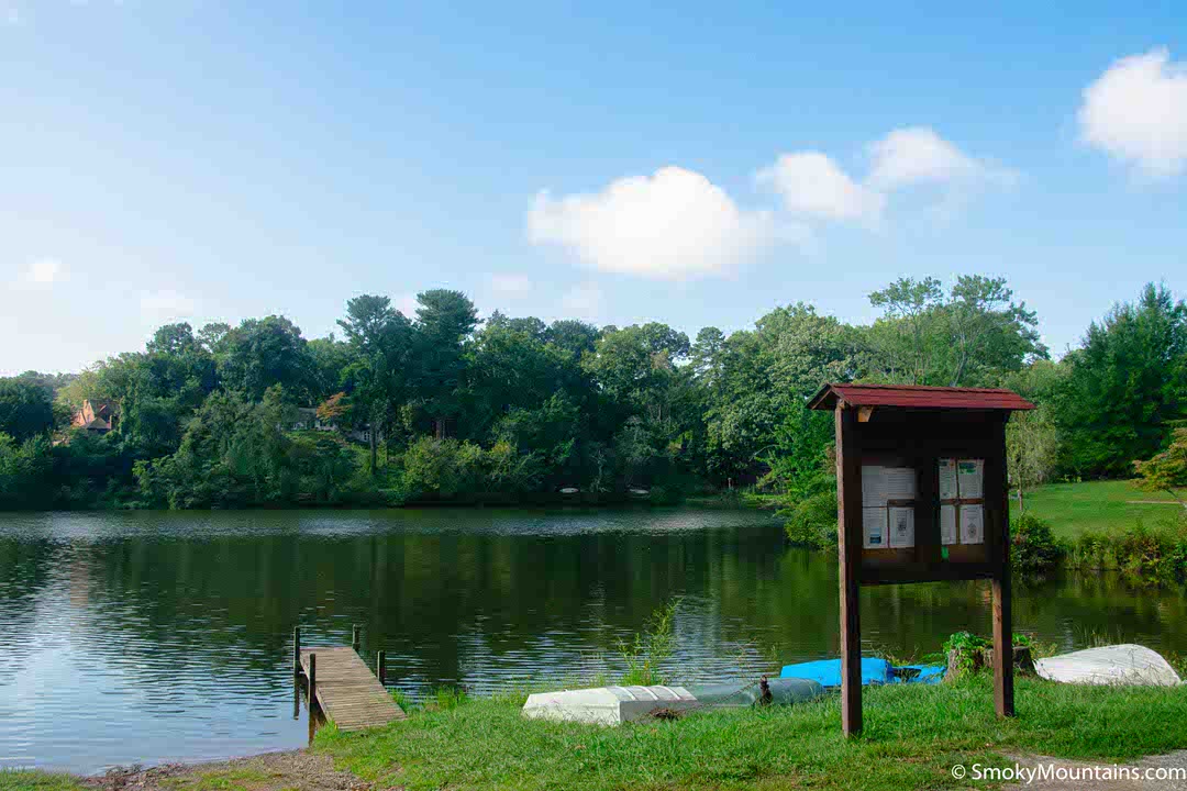
Asheville’s a year-round hiking destination. In fact, we’d venture to say it’s one of the best all-year hiking hotspots in the entire country. That’s partly, of course, because of the sheer beauty, variety, and grandeur of its Blue Ridge surroundings: These ancient highlands, deep forests, and whitewater gorges serve up breathtaking scenery in any season.
It’s also because of the special climate, which makes for generally balmy winters in the lowlands while serving up frosty delights in the high country. This means you often can pursue either snow-free low-elevation hiking or seek out heaps of the white stuff if you’d prefer—or combine both in a single trek!
Table of Contents:
1. Bearwallow Mountain
2. Lover’s Leap
3. John Rock
4. DuPont State Recreational Forest
5. Max Patch
Keep in mind that winter conditions in and around Asheville vary quite a bit from year to year, and sometimes the Asheville Basin receives a generous snowfall. Depending on the weather when you’re visiting during a hike in the lower to mid-elevations, may involve tromping along a bare ground path, dealing with an icy tread, or crunching through the snowpack.
Bearwallow Mountain

The open heights of 4,232-foot Bearwallow Mountain provide superb views over the Hickory Nut Gorge and out to Mount Pisgah, the Black Mountains, the Great Balsams, and other stirring landmarks. Only about 20 miles from downtown Asheville, the Bearwallow Mountain Trail—maintained by the awesome Carolina Mountain Land Conservancy—offers quite an easy two-mile round-trip hike up to this great vantage, topped by a historic fire tower (not open to the public).
Trail Difficulty: Moderately Challenging
Trail Length: 2.1 miles
Elevation Gain: 587 feet
Trail Time:≈1 hour
Parking: Parking is available on the shoulder of the main road
You can extend your Bearwallow adventure by linking this path with the longer Trombatore Trail—which begins at the same trailhead—for a seven-mile winter outing.
GPS for Bearwallow Mountain Here
Lover’s Leap

Photo Credit by @bobwhitetrixie on Instagram
About 36 miles northwest of Asheville, the charming town of Hot Springs, North Carolina along the French Broad River lies astride the Appalachian Trail.
Trail Difficulty: Moderately Challenging
Trail Length: 1.6 miles
Trail Time:≈1 hour
Parking: There is a trailhead parking lot near the Silvermine Trailhead
A classic day hike that gives you the pleasure of following that iconic long-distance footpath is the roughly 1.5-mile loop from Hot Springs up to the outcrop of Lover’s Leap, which delivers swoony views of the village and the river valley.
GPS for Lover’s Leap Here
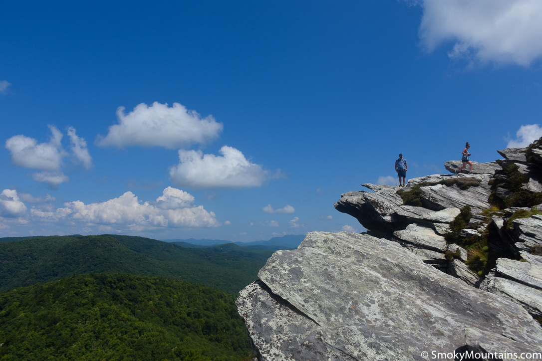
John Rock

Photo Credit by @katieviancourt on Instagram
The broad, granite brow of John Rock in the Pisgah National Forest provides another stunning vantage, and one reached by a 5-mile round-trip trail that, in winter especially, serves up plenty of great scenery along the way. That includes the lovely Cedar Rock Falls, at optimum visibility in this leafless season. The summit offers memorable sightlines out to such monolithic promontories as the mighty, slab-sided Looking Glass Rock and high-knobbed Pilot Mountain.
Trail Difficulty: Moderately Challenging
Trail Length: 4.6 miles
Trail Time:≈2.5 hours
Parking: There is parking available at the Pisgah Visitor Center
While the summit dome provides an ample stage for soaking up the grand viewshed, don’t get too close to its cliffy edges—especially in slippery winter conditions. (If you’ve got kids along on your winter hike, keep an especially close eye on them up here!) About 40 miles from Asheville, the John Rock Trail kicks off at the Pisgah Center for Wildlife Education.
GPS for John Rock Trail Here
DuPont State Recreational Forest

Photo Credit by @andyefting on Instagram
A mere hour’s drive south of Asheville, the expansive DuPont State Recreational Forest is most famous for its concentration of big waterfalls, including the stunning 125-foot High Falls, the three-tiered Triple Falls (about 120 feet total), and the roughly 800-foot-wide wash of Bridal Veil. (With these sorts of magnificent sights in ample supply, it’s no surprise why such big-budget films as The Hunger Games and The Last of the Mohicans were partly shot here.)
Time, length, and difficulty levels depend on which trail you choose.
Winter hikers in the DuPont enjoy lighter crowds, longer views through naked woods, and the special seasonal incarnations of those granite-washing cataracts, which depending on the prevailing weather can include impressive ice formations as well as all-out snowy shoulders. The excellent system of trails allows you to take in one or two falls, or combine all of the major ones in a single big walkabout.
GPS for DuPont State Recreational Forest Here
Max Patch

Set up at 4,600 feet, the wide-open mountaintop grass bald called Max Patch offers one of the most lauded panoramas on the entire, 2000-mile run of the Appalachian Trail. It’s also a very doable winter trek of 1.5 miles round-trip, though we recommend inquiring ahead as to current road conditions and taking a 4WD vehicle when the access is snow-covered.
Trail Difficulty: Easy
Trail Length: 1.5 miles
Trail Time:≈1 hour
Parking: There is a small parking lot below the bald
The views from up here are arguably at their best in the cold, still air of wintertime, with unforgettable looks at the highest country in the eastern U.S.: from the Great Smoky and Black Mountains to the Great Craggies and the Great Balsams.
GPS for Max Patch Here
Winter Revelry on Asheville-area Hiking Trails

From the gargantuan waterfalls of the DuPont to the 360-degree views of Bearwallow Mountain and Max Patch, the winter wonders of the Southern Appalachians beckon right at the doorstep of Asheville. Just remember to pack plenty of warm layers and extra food, wear sturdy boots, and tote a pair of crampons or other traction devices if trails are icy or hard-crusted.