


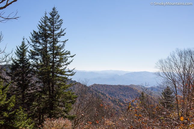


This popular hiking trail is approximately 1.8 miles to Andrews Bald for a total of 3.6 miles round trip. Since the trail offers incredible views of the Great Smoky Mountains and surrounding highlands, it is the perfect hike for fit families – the trail should take approximately three hours.
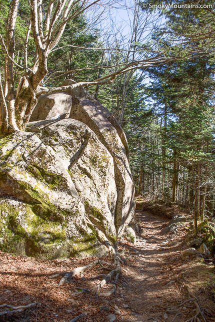
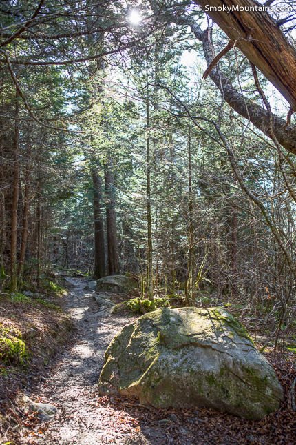
However, due to the rocky terrain, it is important to note that this trail is somewhat strenuous. Previously, the hiking trail was marred with loose gravel, drainage run off, haphazard boulders and rough surfaces. As of 2008, the trail experienced a major renovation that includes new staircases built from native rock and locust wood, boardwalks, and better drainage. Now, the Andrews Bald hike is no longer considered one of the most rugged trails in the Great Smoky Mountains National Park. In fact, many hikers feel that the diverse walkways and natural stairwells that greet hikers along the Forney Ridge Trail toward Andrews Bald add visual elements that make the hike more enjoyable!
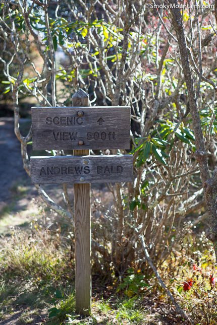
The hike to Andrews Bald begins on the Forney Ridge Trail, which is located at the far end of the Clingmans Dome parking lot. The Forney Ridge Trail (the one you want to be on!) is the trail to the left of the Clingmans Dome paved path.
During the 3.6 mile hike, you will gain approximately 899 feet and pass through dense and dark forests. You may notice that younger trees are taking the place of mature Fraser firs, which once covered the mountain. Other plant life to anticipate on a hike to Andrews Bald include raspberry and blackberry patches prime for the picking. For flower lovers, Quaker ladies (also known as innocence or bluets), which are a petite blue wildflower, grow throughout Andrews Bald.
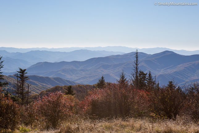
Your hike will come out of the thick forest floor, opening up to the view of the bald. In case you are wondering, a bald is an area of high elevation and grassy meadows, which are located throughout the Southern Appalachian Mountains. Most notably, Andrews Bald is the highest bald in the mountain range. When you reach the bald of Andrews namesake prepare to be inspired by native flame azaleas and Catawba rhododendron. Andrews Bald was named for Andres Thompson, a cattle herder who brought his bovine here to munch on the grass in the 1840s.
If you still have energy when you finish this trail, the brief one-mile, paved roundtrip hike to Clingmans Dome offers awe-inspiring views that are sure to please!
Directions:
To get to the Andrews Bald trailhead, proceed into the National Park from Gatlinburg. After passing the Sugarlands Visitor Center on your right, you will continue 13.2 miles to Clingmans Dome Road. Turn right and continue 7 miles on Clingmans Dome Road until it dead ends into the parking area.

Insider Tips:
-Go during the mid-June to early July to experience the full glory of floral blossoms of flame azaleas and Catawba rhododendron. The azaleas provide the greatest show in the Smoky Mountains, save for Gregory Bald, which has the most spectacular presentation of azaleas.
-Choose a clear day for this hike and you’ll be rewarded by views of the Noland Creek watershed to the east. Fontana Lake in the southwest is equally visible on clear days.
-Heavy rains are common at Andrews Bald and make for a creek bed rather than a walking trail. While the trail maintenance by the Friends of the Smokies has improved the situation, you’ll want to steer clear on days following heavy rains or when the forecast is wet.
-Get to the parking area before sunrise to avoid the crowds. As your reward you will be able to hike to Andrews Bald before the crowds, which easily fill the Forney Ridge Parking Area on the weekends.